Odisha, a place teeming with life, is home to multiple rivers. Think of these rivers as pathways, guiding precious water across the landscape. They’re crucial for life and the economy. To name a few, let’s think about the Mahanadi, Brahmani, Baitarani, and Subarnarekha. Additionally, we can’t forget the Budhabalanga, Rushikulya, Vamsadhara, and Indravati. But Odisha isn’t just about rivers—it also boasts a wealth of lakes, waterfalls and springs.
The rivers of Odisha are mainly Peninsular and non-perennial, relying on rainfall for their flow. These rivers play a crucial role in the state’s development, serving as vital sources of irrigation and hydroelectric power.
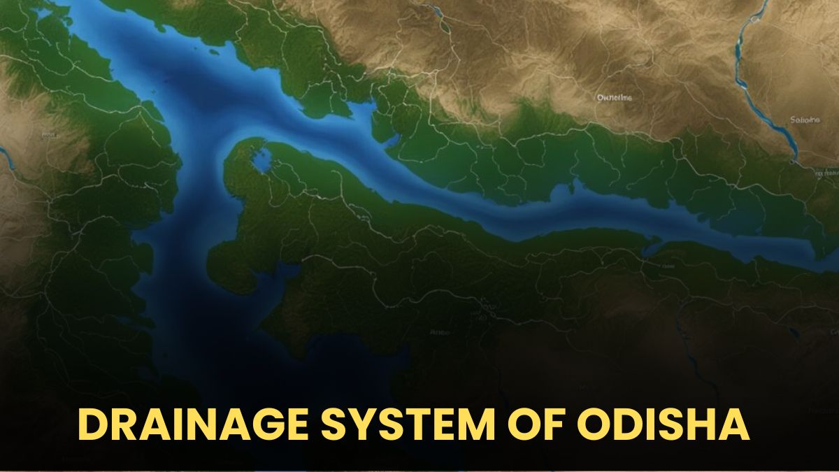
Rivers of Odisha
Odisha has many important rivers which flow into the Bay of Bengal. These rivers
are divided into six groups on the basis of their sources or origin. They are as follows:
i. Chota Nagpur Plateau The Subarnarekha and the Brahmani.
ii. Amarkantak Plateau The Mahanadi river sourcing.
iii. Mahanadi Delta The Soamoli, the Gobari, the Prachi, the Kadua, the Dhanua,
the Ratnachira and the Nuna river.
iv. Keonjhar Plateau The Baitarani river.
v. Eastern Slopes of Eastern Ghats The Budhabalanga, the Rushikulya the Salandi
river.
vi. Other Rivers from Eastern Ghats The Bahuda, the Nagavali, the Vamsadhara and
the Godavari system.
Rivers of Chota Nagpur Plateau
The rivers originating from the Chota Nagpur Plateau are as follows:
Subarnarekha River
- Origin and Length: The Subarnarekha River starts from the southern slopes of the Chota Nagpur Plateau in Bihar. It stretches for a total of 433 km, with 70 km flowing through Odisha.
- Catchment Area: The river’s total catchment area is 19,500 sq km, out of which 3,200 sq km lies in Odisha.
- States it Flows Through: This river flows through Jharkhand, Odisha, and West Bengal, making it a multi-state river.
- Boundary Formation: It forms a boundary between Odisha and West Bengal. It enters Odisha at Lakshmannath, located northeast of Jaleshwar, and finally empties into the Bay of Bengal.
- Districts in Odisha: In Odisha, it flows through Mayurbhanj and Balasore districts.
- Tributaries:
- Right Bank: Kanchi, Karkari, Kharkai (longest tributary), Raru, Garru.
- Left Bank: Dulang.
Brahmani River
- Origin and Length: The Brahmani River also originates from the southern slopes of the Chota Nagpur Plateau in Bihar and enters Odisha through Sundargarh district. The river is 799 km long in total, with 480 km flowing through Odisha.
- Catchment Area: The catchment area of the Brahmani River in Odisha is 39,055 sq km.
- Rank in Odisha: Brahmani is the second-largest river in Odisha.
- Formation: It is formed by the joining of two smaller rivers, Sankh (right bank) and Koel (left bank), at Vedvyasa near Rourkela in Sundargarh district.
- Course and Use:
- Course: From Rourkela to Talcher, the river flows north-south. At Rengali, south of Barkot, the river forms a minor gorge.
- Uses: Its water is used for irrigation and generating hydropower.
- Districts in Odisha: The Brahmani River flows through Sundargarh, Angul, Dhenkanal, Deogarh, Jajapur, Kendrapara, and Cuttack districts.
- Tributaries:
- Right Bank: Sankh, Gohira, Lingarajara, Tikra, Singda, Nandia.
- Left Bank: Ramial, Samakoi, Mankada, Kurali.
- Interesting Facts:
- Connection with Mahanadi: Brahmani’s right bank tributary, Sankh, meets Mahanadi’s left bank tributary, Birupa.
- Flood Outlets: The Brahmani and Mahanadi rivers share a common outlet for their floodwaters through Maipura. They also created the Wheeler islands.
- Final Journey: Before discharging into the Bay of Bengal near Dhamra, the Brahmani receives floodwaters from the Baitarani River.

Summary Tables
| River | Origin | Total Length | Length in Odisha | Catchment Area | Odisha Districts |
|---|---|---|---|---|---|
| Subarnarekha | Southern slopes of Chota Nagpur, Bihar | 433 km | 70 km | 19,500 sq km | Mayurbhanj, Balasore |
| Brahmani | Southern slopes of Chota Nagpur, Bihar | 799 km | 480 km | 39,055 sq km | Sundargarh, Angul, Dhenkanal, Deogarh, Jajapur, Kendrapara, Cuttack |
| River | Right Bank Tributaries | Left Bank Tributaries |
|---|---|---|
| Subarnarekha | Kanchi, Karkari, Kharkai, Raru, Garru | Dulang |
| Brahmani | Sankh, Gohira, Lingarajara, Tikra, Singda, Nandia | Ramial, Samakoi, Mankada, Kurali |
River of Amarkantak Plateau
Mahanadi River
- Origin and Length: The Mahanadi River originates from the Amarkantak hills of the Bastar Plateau in Raipur district, Chhattisgarh. The river has a total length of 858 km, with 494 km flowing through Odisha.
- Nickname: The Mahanadi is known as the “Sorrow of Odisha” due to its frequent flooding.
- Catchment Area: In Odisha, the river’s catchment area is 65,580 sq km.
- Importance:
- It is the largest river in Odisha and the sixth-largest in India.
- The river flows through Chhattisgarh and enters Odisha near Padigan.
- The Hirakud Dam, built over the Mahanadi, is the longest dam in the world.
- Course:
- From Sambalpur to Sonepur, the river flows almost in a north-south direction.
- The Jira and Jhaun rivers, right bank tributaries, join the Mahanadi in this region, draining the Baragarh plain.
- Major Tributary: The Tel River, the largest tributary of the Mahanadi, joins it on the right bank at Sonepur.
- Districts and Cities in Odisha: The Mahanadi flows through the districts of Sambalpur, Sonepur, and Cuttack, and cities like Bhubaneshwar, Subalaya, Kantilo, Boudh, and Banki.
- Before entering Cuttack, it forms a distributary called the Kathajodi.
- From Boudh to Banki, the river crosses through the Eastern Ghats, forming the Satkosia Gorge.
- At Naraj in the Cuttack district, the Mahanadi reaches the plains and meets the old shoreline of the Bay of Bengal, forming a delta.
- Final Destination: The river eventually empties into the Bay of Bengal near Jagatsingpur.
- Tributaries:
- Right Bank: Silari, Sondur, Jonk, Sukha, Kharkhara, Brutanga.
- Left Bank: Chhinar, Seonath, Hasdeo, Son, Mand, Kelo, Surli, Bhidan.
- Special Note: While most of the Mahanadi’s tributaries flow into the Bay of Bengal, the Daya and Bhargavi rivers fall into Chilika Lake instead.
read more – geographical feature of odisha
| Attribute | Details |
|---|---|
| Origin | Amarkantak hills, Bastar Plateau, Raipur, Chhattisgarh |
| Total Length | 858 km |
| Length in Odisha | 494 km |
| Nickname | Sorrow of Odisha |
| Catchment Area in Odisha | 65,580 sq km |
| Important Tributaries | Right Bank: Silari, Sondur, Jonk, Sukha, Kharkhara, Brutanga Left Bank: Chhinar, Seonath, Hasdeo, Son, Mand, Kelo, Surli, Bhidan |
| Major Tributary | Tel River |
| Districts and Cities in Odisha | Sambalpur, Sonepur, Cuttack, Bhubaneshwar, Subalaya, Kantilo, Boudh, Banki |
| Important Feature | Forms a distributary called Kathajodi before entering Cuttack; Forms a Gorge at Satkosia; Creates a delta at Naraj |
| Final Discharge | Bay of Bengal, near Jagatsingpur |
| Special Note | Daya and Bhargavi rivers fall into Chilika Lake |
Rivers of Mahanadi Delta
Mahanadi River
- Origin and Length: The Mahanadi River originates from the Amarkantak hills of the Bastar Plateau in Raipur district, Chhattisgarh. The river has a total length of 858 km, with 494 km flowing through Odisha.
- Nickname: The Mahanadi is known as the “Sorrow of Odisha” due to its frequent flooding.
- Catchment Area: In Odisha, the river’s catchment area is 65,580 sq km.
- Importance:
- It is the largest river in Odisha and the sixth-largest in India.
- The river flows through Chhattisgarh and enters Odisha near Padigan.
- The Hirakud Dam, built over the Mahanadi, is the longest dam in the world.
- Course:
- From Sambalpur to Sonepur, the river flows almost in a north-south direction.
- The Jira and Jhaun rivers, right bank tributaries, join the Mahanadi in this region, draining the Baragarh plain.
- Major Tributary: The Tel River, the largest tributary of the Mahanadi, joins it on the right bank at Sonepur.
- Districts and Cities in Odisha: The Mahanadi flows through the districts of Sambalpur, Sonepur, and Cuttack, and cities like Bhubaneshwar, Subalaya, Kantilo, Boudh, and Banki.
- Before entering Cuttack, it forms a distributary called the Kathajodi.
- From Boudh to Banki, the river crosses through the Eastern Ghats, forming the Satkosia Gorge.
- At Naraj in the Cuttack district, the Mahanadi reaches the plains and meets the old shoreline of the Bay of Bengal, forming a delta.
- Final Destination: The river eventually empties into the Bay of Bengal near Jagatsingpur.
- Tributaries:
- Right Bank: Silari, Sondur, Jonk, Sukha, Kharkhara, Brutanga.
- Left Bank: Chhinar, Seonath, Hasdeo, Son, Mand, Kelo, Surli, Bhidan.
- Special Note: While most of the Mahanadi’s tributaries flow into the Bay of Bengal, the Daya and Bhargavi rivers fall into Chilika Lake instead.
| Attribute | Details |
|---|---|
| Origin | Amarkantak hills, Bastar Plateau, Raipur, Chhattisgarh |
| Total Length | 858 km |
| Length in Odisha | 494 km |
| Nickname | Sorrow of Odisha |
| Catchment Area in Odisha | 65,580 sq km |
| Important Tributaries | Right Bank: Silari, Sondur, Jonk, Sukha, Kharkhara, Brutanga Left Bank: Chhinar, Seonath, Hasdeo, Son, Mand, Kelo, Surli, Bhidan |
| Major Tributary | Tel River |
| Districts and Cities in Odisha | Sambalpur, Sonepur, Cuttack, Bhubaneshwar, Subalaya, Kantilo, Boudh, Banki |
| Important Feature | Forms a distributary called Kathajodi before entering Cuttack; Forms a Gorge at Satkosia; Creates a delta at Naraj |
| Final Discharge | Bay of Bengal, near Jagatsingpur |
| Special Note | Daya and Bhargavi rivers fall into Chilika Lake |
River of Keonjhar Plateau
Baitarani River
- Origin: The Baitarani River originates from the Gonasika or Guptaganga hills in the Mayurbhanj district of Odisha. It is an eastward-flowing river of Peninsular India.
- Boundary: Initially, the river forms a boundary between Odisha and Jharkhand.
- Length and Catchment Area:
- The total length of the Baitarani River is 365 km.
- It has a catchment area of 12,190 sq km.
- Course:
- The river initially flows in a northerly direction.
- It then makes a sudden 90-degree turn and flows eastward.
- Districts: The Baitarani flows through the districts of Keonjhar, Mayurbhanj, Sundargarh, Bhadrak, Jajpur, and Kendrapara in Odisha.
- Tributaries:
- Major tributaries include the Salandi and Matai rivers.
- Other tributaries are Kangira, Ardei, Khairi, Bhandan, Deo, Kanjhari, Sita, Musal, and Kusei.
- Final Destination: The Baitarani River eventually joins the Brahmani River at Dhamra in the Bhadrak district and then flows into the Bay of Bengal.
| Attribute | Details |
|---|---|
| Origin | Gonasika or Guptaganga hills, Mayurbhanj, Odisha |
| Total Length | 365 km |
| Catchment Area | 12,190 sq km |
| Initial Direction | Northerly, then turns eastward |
| Districts in Odisha | Keonjhar, Mayurbhanj, Sundargarh, Bhadrak, Jajpur, Kendrapara |
| Major Tributaries | Salandi, Matai |
| Other Tributaries | Kangira, Ardei, Khairi, Bhandan, Deo, Kanjhari, Sita, Musal, Kusei |
| Final Discharge | Bay of Bengal after joining Brahmani at Dhamra |
Rivers of Eastern Slopes of EasternGhats
Budhabalanga River
- Origin: The Budhabalanga River originates from the Simlipal massif, located south of the Simlipal Garh in the Mayurbhanj district of Odisha.
- Length and Catchment Area:
- The river has a total length of 175 km.
- The catchment area is approximately 4,840 sq km.
- Historical Significance: The valley of the Budhabalanga River is home to Paleolithic and Neolithic sites.
- Districts: It flows through the Mayurbhanj and Balasore districts of Odisha.
- Tributaries: Key tributaries include the Sanjo, Deo Kalo, Sone, Palpala, Katra, and Gangadhar rivers.
- Final Destination: The river drains into the Bay of Bengal off the Balasore coast, slightly north of Chandipur.
Rushikulya River
- Origin: The Rushikulya River originates from the Rushimal mountain in the Kandhamal district of Odisha.
- Length and Catchment Area:
- The river’s total length is 165 km.
- It has a catchment area of about 8,963 sq km.
- Cities and Course: The river flows southeast through the Ganjam district, covering cities like Berhampur, Chhatrapur, Asika, Bhanjanagar, and Sarada.
- Final Destination: It flows through the Chhatrpur block and drains into the Bay of Bengal. Despite being the lifeline of the Ganjam district, the river does not form a delta at its mouth.
- Basin Shape: The Rushikulya River basin is pear-shaped, with a well-developed dendritic tributary system.
- Tributaries:
- Right bank tributaries: Padma and Ghodahada.
- Left bank tributaries: Baghua and Dhanei.
Salandi River
- Origin: The Salandi River originates from the southern slopes of the Simlipal massif, specifically at the Meghasani mountain in the Keonjhar district of Odisha.
- Length and Catchment Area:
- The river has a total length of about 144 km.
- The catchment area is about 1,790 sq km.
- Course: It flows through the Bhadrak district of Odisha.
- Connection to Baitarani River: The Salandi River is a tributary of the Baitarani River. It does not directly drain into the Bay of Bengal but instead discharges its water into the Baitarani River a few kilometers upstream of Chandbali.
- Salandi Dam: The Salandi Dam, part of the Salandi Project, is built on this river and is used primarily for irrigation purposes.
| River | Origin | Length | Catchment Area | Key Districts | Tributaries | Final Destination |
|---|---|---|---|---|---|---|
| Budhabalanga | Simlipal massif, Mayurbhanj, Odisha | 175 km | 4,840 sq km | Mayurbhanj, Balasore | Sanjo, Deo Kalo, Sone, Palpala, Katra, Gangadhar | Bay of Bengal (near Chandipur) |
| Rushikulya | Rushimal mountain, Kandhamal, Odisha | 165 km | 8,963 sq km | Ganjam | Right: Padma, Ghodahada; Left: Baghua, Dhanei | Bay of Bengal |
| Salandi | Meghasani mountain, Keonjhar, Odisha | 144 km | 1,790 sq km | Bhadrak | Tributary of Baitarani | Baitarani River |
Rivers of Eastern Ghats
Bahuda River
- Origin: The Bahuda River originates from the Singharaj hills in the Eastern Ghats, located in the Gajapati district of Odisha.
- Length and Course:
- The river has a total length of 96 km.
- Initially, it flows in a northeast direction for 55 km, then turns southeast for 17 km within Odisha. Afterward, it enters Andhra Pradesh for 18 km, and finally returns to Odisha for 6 km before meeting the Bay of Bengal near the Sunapurapeta village.
- Tributaries: The important tributaries of the Bahuda River include Poichandia, Bogiriadi, Batrada Nalla, and Kantajura Nalla.
Nagavali River
- Origin: The Nagavali River originates from the eastern slopes of the Eastern Ghats near Lakhbahal in the Kalahandi district of Odisha. It is also known as the Langulya River.
- Length and Catchment Area:
- The total length of the river is 256 km, with 161 km lying within Odisha and the rest in Andhra Pradesh.
- The river has a catchment area of approximately 4,500 sq km in Odisha.
- Course: The river passes through Vizianagaram and Srikakulam districts and finally drains into the Bay of Bengal near Mofaz Bandar.
- Tributaries: Important tributaries include Pitadar, Satnala, Barha, Srikona Nadi, Vegavati, Baldiya Nadi, Jhanjavathi, Sitagurha, Gumudugedda, and Vonigedda.
Vamsadhara River
- Origin: The Vamsadhara River originates from the Niyamagiri hills in the Kalahandi district of Odisha.
- Length and Catchment Area:
- The river is about 230 km long, with 150 km within Odisha.
- The catchment area in Odisha is around 8,960 sq km.
- Course: The river flows through the cities of Paralakhemundi, Gunupur, Kashinagar, and Bissam Cuttack in Odisha, and then enters Andhra Pradesh.
- Final Destination: It drains into the Bay of Bengal at Kalingapatnam in Andhra Pradesh.
- Tributaries:
- Right bank tributaries: Poladi, Bhangi, and Pedagoda.
- Left bank tributaries: Badanalla, Chauladhua, Pandaka Nalla, Badajhar, Harbhangi, Sananadi, and Mahendratanaya.
Godavari System
- Overview: The Godavari river system includes several tributaries such as the Indravati, Kolab, Machkund, and Sileru rivers.
Indravati River
- Origin: The Indravati River originates from a small rivulet in the Dandakaranya range of the Eastern Ghats in the Kalahandi district of Odisha.
- Length and Catchment Area:
- The total length of the river is about 530 km, with 167 km within Odisha.
- The catchment area in Odisha is around 7,400 sq km.
- Course: The river flows southeastward, then turns westward through the Kalahandi, Nabarangpur, and Koraput districts, forming a boundary between Odisha and Chhattisgarh before entering the Bastar district of Chhattisgarh.
- Tributaries:
- Left bank tributaries: Keshadhara Nalla, Kandabindha Nalla, Chandragiri Nalla, Golagar Nalla, Poragarh Nalla, Kapur Nalla, Muran River, Bangiri Nalla, and Telengi Nalla.
- Right bank tributaries: Narangi Gudar, Nimbra, Kotri, Bhaskel, and Bandia.
Kolab River
- Origin: The Kolab River originates from the Sinkaran hills of the Eastern Ghats in the Koraput district of Odisha.
- Length and Catchment Area:
- The river has a total length of about 270 km within Odisha.
- The catchment area is approximately 10,300 sq km in Odisha.
- Significance: The Kolab Dam is located on this river, supporting the Upper Kolab Hydro Electric Project.
- Tributaries: Important tributaries include Karandi Nalla, Guradi Nalla, Kangar Nalla, Garia, Dharmageda Nalla, Jamnadi, Jalengar, Mulervagu Nalla, and Potteru Vagu Nalla.
- Final Destination: The river eventually meets the Godavari River in Andhra Pradesh.
Machkund (Sileru) River
- Origin: The Sileru River, also known as the Machkund River, originates in the Eastern Ghats of northeastern Andhra Pradesh.
- Course: It flows northward into the Jalaput Reservoir on the Odisha-Andhra Pradesh border. Afterward, the river turns sharply southwest and flows through southwestern Odisha.
- Final Destination: The Sileru River meets the Sabari River at Motu, located at the extreme southwestern point of Odisha.
- Hydroelectric Dams: Several hydroelectric dams, including those at Jalaput Reservoir and on the upper and lower courses of the Sileru River, provide significant power to the region. The Balimela Reservoir is also part of this hydroelectric system.
Here’s a table summarizing the details of the rivers mentioned:
| River | Origin | Total Length | Catchment Area | Course | Tributaries | Final Destination |
|---|---|---|---|---|---|---|
| Bahuda River | Singharaj hills, Gajapati, Odisha | 96 km | – | Flows northeast, southeast, enters Andhra Pradesh, returns to Odisha, drains into the Bay of Bengal near Sunapurapeta village. | Poichandia, Bogiriadi, Batrada Nalla, Kantajura Nalla | Bay of Bengal near Sunapurapeta village, Odisha |
| Nagavali River | Eastern Ghats, Lakhbahal, Kalahandi, Odisha | 256 km | 4,500 sq km | Flows through Odisha and Andhra Pradesh, passes through Vizianagaram, Srikakulam, drains into Bay of Bengal near Mofaz Bandar. | Pitadar, Satnala, Barha, Srikona Nadi, Vegavati, Baldiya Nadi, Jhanjavathi, Sitagurha, Gumudugedda, Vonigedda | Bay of Bengal near Mofaz Bandar, Andhra Pradesh |
| Vamsadhara River | Niyamagiri hills, Kalahandi, Odisha | 230 km | 8,960 sq km | Flows through Paralakhemundi, Gunupur, Kashinagar, Bissam Cuttack in Odisha, enters Andhra Pradesh, drains into Bay of Bengal at Kalingapatnam. | Right bank: Poladi, Bhangi, Pedagoda; Left bank: Badanalla, Chauladhua, Pandaka Nalla, Badajhar, Harbhangi, Sananadi, Mahendratanaya | Bay of Bengal at Kalingapatnam, Andhra Pradesh |
| Indravati River | Dandakaranya range, Kalahandi, Odisha | 530 km | 7,400 sq km | Flows southeast, then westward through Kalahandi, Nabarangpur, Koraput districts, forms boundary between Odisha and Chhattisgarh. | Left bank: Keshadhara Nalla, Kandabindha Nalla, Chandragiri Nalla, Golagar Nalla, Poragarh Nalla, Kapur Nalla, Muran River, Bangiri Nalla, Telengi Nalla; Right bank: Narangi Gudar, Nimbra, Kotri, Bhaskel, Bandia | Bastar district, Chhattisgarh |
| Kolab River | Sinkaran hills, Koraput, Odisha | 270 km | 10,300 sq km | Flows within Odisha, supports Upper Kolab Hydro Electric Project, meets Godavari River in Andhra Pradesh. | Karandi Nalla, Guradi Nalla, Kangar Nalla, Garia, Dharmageda Nalla, Jamnadi, Jalengar, Mulervagu Nalla, Potteru Vagu Nalla | Godavari River, Andhra Pradesh |
| Machkund (Sileru) River | Eastern Ghats, Andhra Pradesh | – | – | Flows northward into Jalaput Reservoir on Odisha-Andhra Pradesh border, turns southwest, flows through southwestern Odisha, meets Sabari River. | Hydroelectric dams at Jalaput Reservoir and on the upper and lower courses of Sileru River provide significant power. Balimela Reservoir generates hydel power. | Meets Sabari River at Motu, southwestern Odisha |
Lakes in Odisha: Natural and Artificial
Odisha has several natural and artificial lakes. Here’s a breakdown of the important ones:
Natural Lakes
Ansupa Lake
- Type: Freshwater Lake
- Location: At the foot of Saranda hills, Cuttack district
- Shape: Horse-shoe shape
- Size: 5 km long, 1.6 km wide
- Connection: Linked to the Mahanadi river by a channel called Kabula Nalla
- Importance: Shelter for migratory birds during winter
Chilika Lake
- Type: Brackish Water Lagoon
- Location: Mouth of the Daya river, spread across Puri, Khurda, and Ganjam districts
- Size: 1,165 sq km during monsoon, 900 sq km in summer
- Special Features: Largest brackish water lagoon in Asia, designated as a Ramsar site in 1981, bird sanctuary since 1987
- Islands: Includes islands like Krushnaprasad, Nalaban, Kalijai, and more
Kanjia Lake
- Type: Freshwater Lake
- Location: South of Barang, Chandakar area, Khurda district
- Size: 0.75 sq km
- Surroundings: Botanical Garden on the Northern hillocks, Nandankanan Zoological Park on the Southern hillocks
Pata Lake
- Type: Freshwater Lake
- Location: Chhatarpur town, Ganjam district
- Size: 4 km long, 500 m wide
- Attraction: Popular tourist site
Sara Lake
- Type: Freshwater Lake
- Location: Near Puri district
- Size: 5 km long, 3 km wide
Tampara Lake
- Type: Freshwater Lake
- Location: Chhatrapur town, Ganjam district
- Size: 4 km long, 0.5 km wide
Artificial Lakes and Reservoirs
Hirakud Reservoir
- Type: Artificial Lake
- Location: 16 km North of Sambalpur district
- Size: 743 sq km
- Special Features: Part of the Hirakud Dam, the longest dam in the world, attracts migratory birds like common pochard and red-crested pochard
Kolab Reservoir
- Type: Artificial Lake
- Location: Koraput district
- Special Features: Part of Kolab Dam
Sorada Reservoir
- Type: Artificial Reservoir
- Location: Near Berhampur, Ganjam district
- Special Features: Also known as Sorada Ghai, used mainly for irrigation
Comparison Table: Natural vs. Artificial Lakes
| Lake Name | Type | Location | Size | Special Features |
|---|---|---|---|---|
| Ansupa Lake | Freshwater | Cuttack district | 5 km long, 1.6 km wide | Migratory bird shelter, horse-shoe shape |
| Chilika Lake | Brackish Water | Puri, Khurda, Ganjam districts | 1,165 sq km (monsoon) | Largest brackish lagoon in Asia, Ramsar site, bird sanctuary |
| Kanjia Lake | Freshwater | Khurda district | 0.75 sq km | Surrounded by hillocks, near Nandankanan Zoological Park |
| Pata Lake | Freshwater | Ganjam district | 4 km long, 500 m wide | Popular tourist attraction |
| Sara Lake | Freshwater | Near Puri district | 5 km long, 3 km wide | – |
| Tampara Lake | Freshwater | Ganjam district | 4 km long, 0.5 km wide | – |
| Hirakud Reservoir | Artificial Lake | Sambalpur district | 743 sq km | Longest dam in the world, attracts migratory birds |
| Kolab Reservoir | Artificial Lake | Koraput district | – | Part of Kolab Dam |
| Sorada Reservoir | Artificial Lake | Ganjam district | – | Known as Sorada Ghai, used for irrigation |
Waterfalls, Springs, Bays, and Islands in Odisha
Odisha has a rich landscape with many waterfalls, hot springs, bays, and islands. Here’s an easy-to-understand guide to these natural features.
Waterfalls in Odisha
Odisha’s landscape of highlands, uplands, and plateaus gives rise to many beautiful waterfalls. Here are some of the most important ones:
- Badaghagara
- Location: Keonjhar district
- Height: 60 meters
- Special Features: Perennial source of water, formed by the Machha Kandana river
- Barehipani
- Location: Mayurbhanj district
- Height: 400 meters
- Special Features: Highest waterfall in Odisha, second highest in India, formed by the Budhabalanga river
- Duduma
- Location: Border of Andhra Pradesh and Odisha
- Height: 175 meters
- Special Features: Formed by the Machkund river, also called Matsya Tirtha, supports Machkund Hydro Electric Power Project
- Gandahati
- Location: Gajapati district
- Special Features: Waterfall glitters and remains consistent throughout the year
- Harishankar
- Location: Balangir district
- Special Features: Located on the Southern slope of Gandharmardan hills, famous for the temples of Lord Hari and Shankar
- Hatipathar
- Location: Rayagada district
- Special Features: Formed by Nagavali river, named after elephant-shaped boulders
- Jorandha
- Location: Simlipal National Park, Mayurbhanj district
- Height: 150 meters
- Khandadhar
- Location: Sundargarh district
- Height: 244 meters
- Special Features: 12th largest waterfall in Odisha, another Khandadhar waterfall (152 meters) is in Keonjhar district
- Khandula
- Location: Karlapat Wildlife Sanctuary, Kalahandi district
- Special Features: Named after the Goddess Khandula, located at the top of a hill
- Koilighugar
- Location: Jharsuguda district
- Height: 61 meters
- Special Features: Has a Shivalingam (Maheswarnath) inside the fall, formed by the Ahiraj river
- Miriglotah
- Location: Sundargarh district, 111 km from Rourkela
- Height: 100 feet
- Special Features: Located near Kalta iron mines
- Nrusinghanath
- Location: Bargarh district
- Special Features: Near Nrusinghanath temple at the foothills of Gandhamardhan hills, several other small waterfalls like Gadadhar, Pitrudhar, and Bhimadhar
- Phurli Jharan
- Location: Kalahandi district
- Height: 16 meters
- Special Features: Creates a multi-colored rainbow due to sunrays falling on water particles
- Putudi
- Location: Kandhamal district, 15 km from Phulbani
- Special Features: Formed by Bada Saluki river, surrounded by dense forests and hills
- Pradhanpath
- Location: Deogarh district, 100 km from Sambalpur
- Special Features: First hydroelectric power station in Odisha
- Sanaghagra
- Location: Keonjhar district, 5 km from town
- Height: 30 meters
- Special Features: Perennial waterfall, a popular tourist spot
Springs in Odisha
Odisha has many natural springs, mostly developed on the slopes of the Eastern Ghats. These springs are known for their medicinal properties.
- Atri
- Location: Khurda district
- Special Features: Hot sulphur spring with medicinal values, temperature remains constant at 55°C
- Deulajhari
- Location: Angul district
- Special Features: Hot spring originates below a Shivalinga, temperature ranges from 40°C to 62°C, water channelized to 36 ponds
- Taptapani
- Location: Gajapati district, near Mohana town
- Special Features: Hot spring with medicinal sulphur properties, temperature varies from 90°C to 100°C
- Tarabalo
- Location: Nayagarh district
- Special Features: Largest thermal field in Odisha, water used to treat skin diseases, famous picnic spot
- Other Important Springs in Odisha
| Name of the Spring | Location/District |
|---|---|
| Kapilas | Dhenkanal |
| Chandikhol | Cuttack |
| Mahavinayak | Barunei, Khurda |
| Narayani | Puri |
| Nirmal Jhar | Near Khalikot, Ganjam |
| Gosing Jhar | Near Kantilo, Nayagarh |
| Koilighugar | Jharsuguda |
| Jharbada | Near Malayagiri, Dhenkanal |
Bays and Islands in Odisha
- Hukitola Bay: Located on Jambu island in Kendrapara district, formed from silt deposits.
- Islands in Odisha:
- Abdul Kalam Island: Originally Wheeler’s Island, renamed in honor of Dr. APJ Abdul Kalam. It houses an ISRO rocket launching center.
- Subalaya Island: Located where the Mahanadi river meets Surubalijora.
- Shortt’s Island: Located in Banasada Tehsil, Bhadrak district, 72 km from district headquarters.
FAQs
Which river flows over the states of Jharkhand, Odisha, and West Bengal?
Answer: Subarnarekha river.
The tributaries Raru, Kanchi, and Garru belong to which river?
Answer: Subarnarekha.
What is the length of the Brahmani river in Odisha?
Answer: 480 km.
Which is the second largest river in Odisha?
Answer: Brahmani.
Which river is known as the Sorrow of Odisha?
Answer: Baitarani.
What is the largest river in Odisha?
Answer: Mahanadi.
On which river is the Hirakud Dam located?
Answer: Mahanadi.
Which river originates from the Mahanadi Delta?
Answer: (Soamoli River, Nuna River, Prachi River).
Which river originates from the Gonasika hills of Keonjhar district?
Answer: Brahmani.
Which tributary does not belong to the Rushikulya river?
Answer: Karandi Nalla.
What is the total length of the Salandi river?
Answer: 144 km.
From which district does the Bahuda river originate?
Answer: Ganjam.
Which of the following rivers is not a tributary of the Bahuda river?
Answer: Baghua.
Which river is also known as Langulya?
Answer: Nagavali.
Which major East-flowing river lies between the Mahanadi and Godavari rivers?
Answer: Vamsadhara.
Which river originates from the Dandakaranya range of the Eastern Ghats in Kalahandi district?
Answer: Indravati.
What is the other name of the Sileru river?
Answer: Machkund.
Which lake is a horse-shoe shaped freshwater lake?
Answer: Ansupa Lake.
Which lake is directly connected to the Mahanadi river by a channel, Kabula Nalla?
Answer: Ansupa Lake.
Which lake stretches through the districts of Puri, Khurda, and Ganjam?
Answer: Chilika Lake.
Which lake in Odisha is home to many migratory birds from Mongolia, Russia, and South-East Asia?
Answer: Chilika Lake.
Which is one of the largest wintering grounds for migratory waterfowl in India?
Answer: Chilika Lake.
Which lake lies near Puri district of Odisha?
Answer: Sara Lake.
In which district of Odisha does Tampara lake lie?
Answer: Ganjam.
Where is the Kolab reservoir located?
Answer: Koraput.
In which district does the Badaghagara waterfall lie?
Answer: Keonjhar.
Which is the highest waterfall in Odisha?
Answer: Barehipani.
Which waterfall is also known as ‘Matsya Tirtha’?
Answer: Duduma.
Which waterfall in Odisha is located near the Kalta iron mines in Sundargarh district?
Answer: Miriglotah.
The famous shrine of Lord Hatakeswara is situated near which spring?
Answer: Atri.
Which hot spring is the largest thermal field in Odisha?
Answer: Tarabalo.
Which spring is located in Dhenkanal district of Odisha?
Answer: Both Kapilash and Jharbada.
What was the earlier name of Abdul Kalam Island off the coast of Odisha?
Answer: Wheeler’s Island.
1 thought on “Drainage System of Odisha”